Mister Crew

A collection of things on men's clothing and culture

Menu Close

Tag: Maps

Mapping the Pacific Coast

There is a great collection of old maps available for viewing online at Mapping the Pacific Coast. The background:

The maps and illustrations in the Quivira Collection date from 1540 to 1802, a span of 260 years or so. These dates also bracket a period of history unprecedented for the general expansion of knowledge and information. The first application of the new technology of printing to maps and geographical knowledge coincides almost exactly with Columbus’s first voyage in 1492. Thus the maps in this collection span the transition from the European Renaissance to the Age of Enlightenment and bear eloquent testimony to the expansion of useful knowledge.

Being close to home, the maps and explorations of the Pacific Northwest area are of particular interest to me. Some earlier prints:

map_1
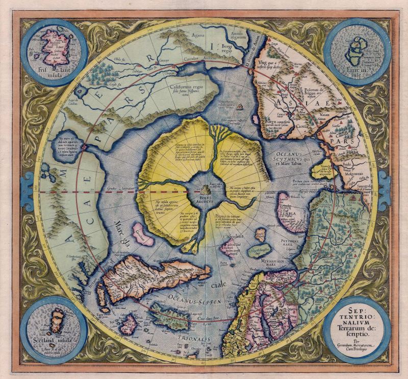
Gerard Mercator, Septentrionalium Terrarum descriptio, Amsterdam, 1595. The innovative and well-known cartographer and author of this map, Gerard Mercator, died in 1594, leaving his son Rumold to publish it in the last of three parts forming the famous Mercator atlas Atlantis Pars Altera. This is not only the first, but also the most influential map to be devoted to the Arctic.

map_2
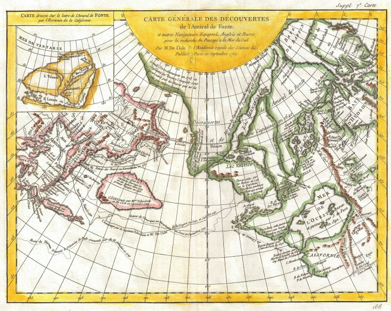
Joseph-Nicolas de l’Isle, Carte Generale des Découvertes de l’Amiral de Fonte. A general map of the discoveries of Admiral de Fonte and other navigators, Spanish, English and Russian in quest of a passage to the South Sea by Mr. De l’Isle of the Royal Academy of Sciences, etc. Published at Paris in September 1752.

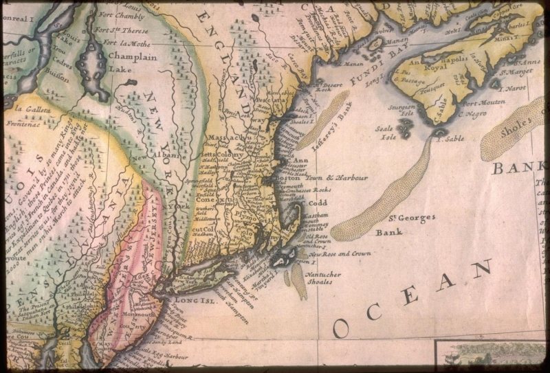
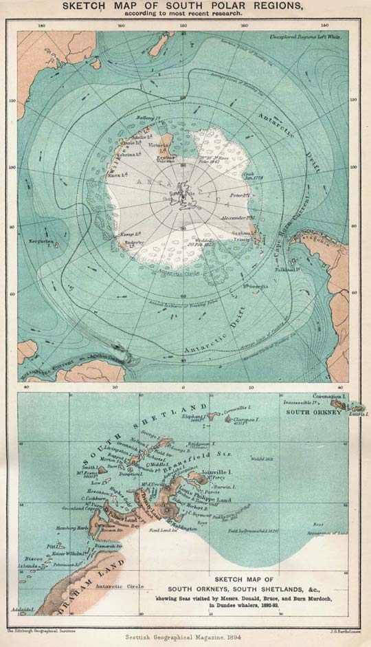
Related Posts: Early New England Maps, Old Maps of Antarctica

Early New England Maps

The Osher Map Library at the University of Southern Maine maintains an extensive cartography collection of early New England maps, and many are available online for viewing.

A Map of the Coast of New England, from Staten Island to the Island of Breton, circa 1775:

Southack captained vessels in New England waters for 22 years. His New England Coasting Pilot (Boston, 1729-33) summarized the wealth of information he had collected about the coast, its hazards, and its currents. Southack’s lists of sailing directions and eight charts guided ship’s captains all the way from the Hudson River to Nova Scotia. Although criticized in the colonies as quite inaccurate, Southack’s work was adopted by London chart makers. The present map was produced in 1744 by combining the eight charts from Southack’s atlas into a single map; between 1775 and 1794 it was often reprinted in the principal English navigational manual for North America, The English Pilot, The Fourth Book.

new_england_map_1
Nova Anglia, Novvm Belgivm, Et Virginia, circa 1630:

The increased interest shown after 1600 by Europeans in the colonization of North America is concisely shown in this map. It shows the English colonies established by 1620 in Virginia and New England, together with the new Dutch colony of the New Netherlands. This map is the first to show New Amsterdam (New York), founded only in 1626. For New England, de Laet clearly relied on John Smith’s map for many place-names (26, 27), but mixed them with those derived from indigenous sources and recorded on older maps (e.g., Norembegua). This is also the first map to show the name Massachusetts.

new_england_map_4
A New and Exact Map of the Dominions of the King of Great Britain, circa 1730:

The vagueness of early European conceptions of the interior of North America are demonstrated by Moll’s map of the English colonies, originally published in 1715 (although the remarkable image of the beavers was copied from a French map of 1698). Once away from the coasts and the St. Lawrence, the interior of North America is shown as a vague jumble of rivers, lakes, and forests.

new_england_map_3

Old Maps of Antarctica

A selection of vintage maps of Antarctica, available on Wikipedia Commons. Included is also a 1916 newspaper printing of a map showing Shackleton’s planned route during the Imperial Trans-Antarctic Expedition “of which news is expected any moment.”

antarctic_map_1894

© 2024 Mister Crew. All rights reserved.

Theme by Anders Norén.