The Osher Map Library at the University of Southern Maine maintains an extensive cartography collection of early New England maps, and many are available online for viewing.
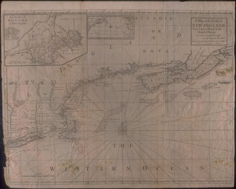
A Map of the Coast of New England, from Staten Island to the Island of Breton, circa 1775:
Southack captained vessels in New England waters for 22 years. His New England Coasting Pilot (Boston, 1729-33) summarized the wealth of information he had collected about the coast, its hazards, and its currents. Southack’s lists of sailing directions and eight charts guided ship’s captains all the way from the Hudson River to Nova Scotia. Although criticized in the colonies as quite inaccurate, Southack’s work was adopted by London chart makers. The present map was produced in 1744 by combining the eight charts from Southack’s atlas into a single map; between 1775 and 1794 it was often reprinted in the principal English navigational manual for North America, The English Pilot, The Fourth Book.
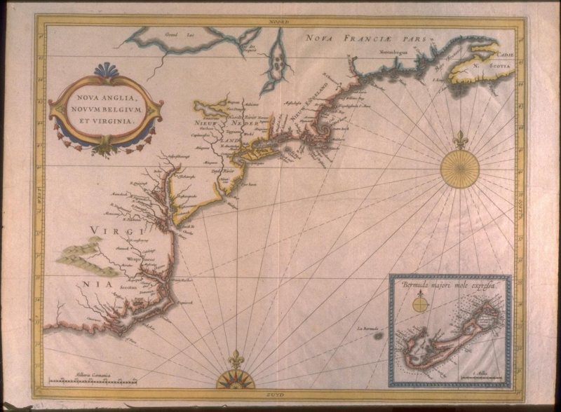
Nova Anglia, Novvm Belgivm, Et Virginia, circa 1630:
The increased interest shown after 1600 by Europeans in the colonization of North America is concisely shown in this map. It shows the English colonies established by 1620 in Virginia and New England, together with the new Dutch colony of the New Netherlands. This map is the first to show New Amsterdam (New York), founded only in 1626. For New England, de Laet clearly relied on John Smith’s map for many place-names (26, 27), but mixed them with those derived from indigenous sources and recorded on older maps (e.g., Norembegua). This is also the first map to show the name Massachusetts.
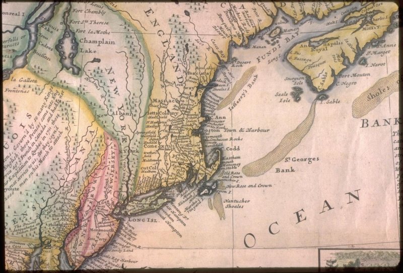
A New and Exact Map of the Dominions of the King of Great Britain, circa 1730:
The vagueness of early European conceptions of the interior of North America are demonstrated by Moll’s map of the English colonies, originally published in 1715 (although the remarkable image of the beavers was copied from a French map of 1698). Once away from the coasts and the St. Lawrence, the interior of North America is shown as a vague jumble of rivers, lakes, and forests.