There is a great collection of old maps available for viewing online at Mapping the Pacific Coast. The background:
The maps and illustrations in the Quivira Collection date from 1540 to 1802, a span of 260 years or so. These dates also bracket a period of history unprecedented for the general expansion of knowledge and information. The first application of the new technology of printing to maps and geographical knowledge coincides almost exactly with Columbus’s first voyage in 1492. Thus the maps in this collection span the transition from the European Renaissance to the Age of Enlightenment and bear eloquent testimony to the expansion of useful knowledge.
Being close to home, the maps and explorations of the Pacific Northwest area are of particular interest to me. Some earlier prints:

Gerard Mercator, Septentrionalium Terrarum descriptio, Amsterdam, 1595. The innovative and well-known cartographer and author of this map, Gerard Mercator, died in 1594, leaving his son Rumold to publish it in the last of three parts forming the famous Mercator atlas Atlantis Pars Altera. This is not only the first, but also the most influential map to be devoted to the Arctic.
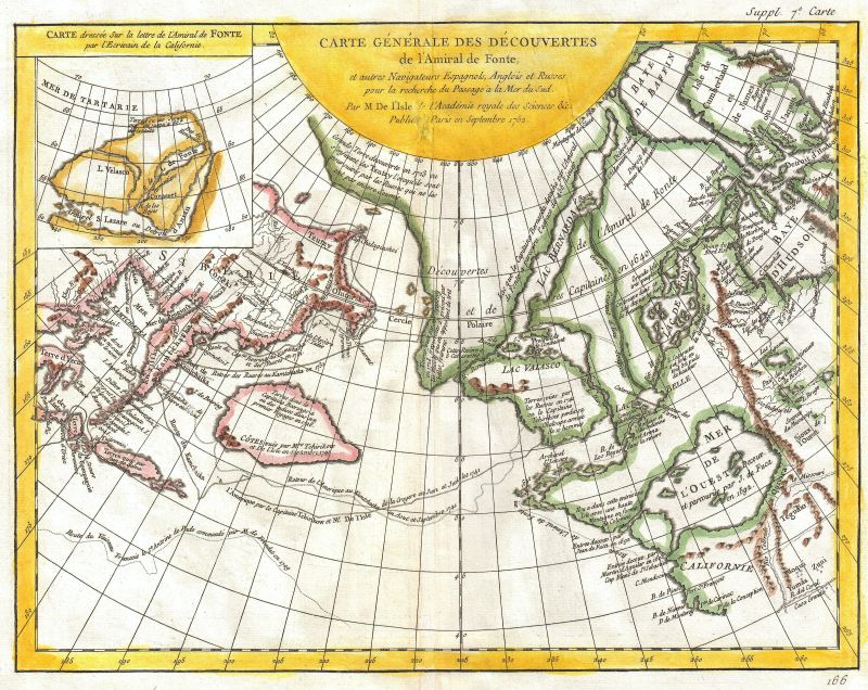
Joseph-Nicolas de l’Isle, Carte Generale des Découvertes de l’Amiral de Fonte. A general map of the discoveries of Admiral de Fonte and other navigators, Spanish, English and Russian in quest of a passage to the South Sea by Mr. De l’Isle of the Royal Academy of Sciences, etc. Published at Paris in September 1752.
Related Posts: Early New England Maps, Old Maps of Antarctica
